Vector Analysis
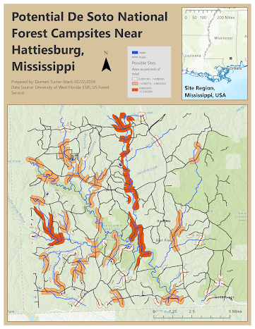
This map, made in ArcGIS, illustrates possible campsite locations in the De Soto National Forest near Hattiesburg, Mississippi. These areas are identified as being within three hundred meters of a road and within one hundred fifty meters of a lake or five hundred meters of a rivers. The regions are also color-coded into three area classes, with the darkest orange representing the areas which comprise the greatest percentage of the whole.
Throughout this project, I learned how to conduct vector analysis and used a variety of geoprocessing tools to conduct complex selections based on feature attributes and distances. I created the above map using a fixed distance buffer and a variable distance buffer and performed a union of the resulting shapes, then erased designated conservation areas from the selection area.
I also analyzed a group of datasets related to Escambia County public services and superact risk features, conducting actions including using select by location to find features within, finding intersecting features, and spatially joining tables.


Comments
Post a Comment